Gallery Highlights
In the highlights section of the BuyNow catalog, we present some personal favorites from our large stock of authentic maps, atlases, prints, globes, posters and Medieval manuscripts.
The items are immediately available, and no commission is charged.
Feel free to contact us if you have a question or if you are looking for a specific item.
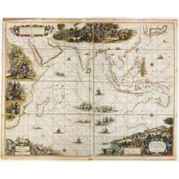
Pascaerte van OOST INDIEN, Met de Omgelegen Eylanden; als Madagascar, Ceylon, Sumatra, Iava, Borneo, Celebes, Molucco en Banda : van C. de Bona Speranca tot Japan. DONCKER, H. (Amsterdam, 1670) Finely hand-colored by the master colorist Dirk Jansz. van Santen, heightened with gold and decorated with ships, wind roses, large cartouches.
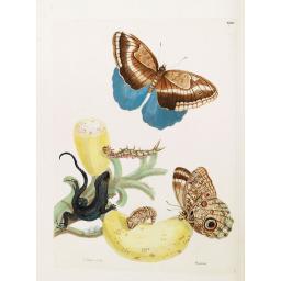
Maria Sibylla Merian was the daughter of the well-known Swiss engraver/publisher Matthaeus Merian. Her mother was Dutch, and after Matthaeus' early death she married the flower painter Jacob Marrell.
Tradition has it that it was one of his pupils, Johann Graff of Nuremberg, who first taught Maria to paint, and certainly they later married. Two of Maria's primary interests were botany and entomology and the present work reflected that interest.
-256x256.jpg)
SUHARAYA MOHE - Bunken Edo oezu. [Tokyo] Bunken Edo oezu : kan / zuko Kanamaru Hikogoro Kagenao. Kyowa 3 or 1803. Impressive large-scale plan of Edo (Tokyo, based on a map by Ochikochi Doin.
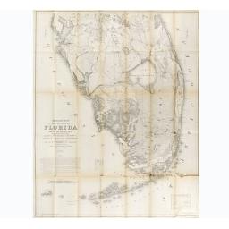
First edition of this large cornerstone map of Florida, produced during the Third Seminole War. The map was issued to illustrate "Memoir to accompany a Military Map of The Peninsula Of Florida", published in 1856. The main areas of activity during the Third Seminole War, the territory just west of Lake Okeechobee, and the northern end of Big Cypress Swamp, are shown in incomparable detail.
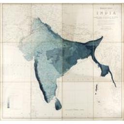
BLANFORD, Henry Francis. Rainfall chart of India, showing the average annual distribution of the rainfall according to locality and season. Calcutta, 1883/January 1884.
-256x256.jpg)
Two captains chart books from the Genova privateer "Stella del Mare" made during its voyage from Genova to Macao and Hongkong
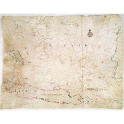
One of the few manuscript charts on vellum in private hands, signed by Isaac de Graaf. ORIGINAL MANUSCRIPT MAP IN RED, GREEN, AND BLACK INK showing the Java Sea centered on the Island of Java, the Southern part of Borneo, and parts of Sumatra, with Bali Island nearby.
-256x256.jpg)
AN EARLY ISSUE of this biting and vulgar satire on the Mississippi and South Sea Bubbles and an extraordinary visual record with 78 plates of the first banking crash, showing the shocking effects of the “South Sea Bubble” in France, England and Holland, and placing John Law (1671-1729), with his Mississippi company scheme, squarely at the center of the disastrous chain of events.
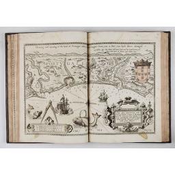
Lucas Janszoon Waghenaer (1533-1606), one of the brightest lights of Dutch Golden-Age mapmaking, distinguished himself from many of his fellow stars by some 14 years of seafaring
